Posts

Showing posts from 2015

Having Cake and Eating It, Too

Image
I've never had it all, haven't even come close and I don't ever expect to. I would, however, like to have my cake and eat it, too. That's what today felt like as I worked out what used to be irreconcilable - traverse overland with a fifteen foot kayak. We've been navigating lakes and the Pacific in roto-molded sit-on-top kayaks by Ocean Kayaks and loved every moment of the decade they spent on top of our trucks and beneath our soggy bottoms. Even though we put the road miles on them from here to the coast, they'd make off-road adventure impossible. Often in our overlanding we'd come across a body of water and damn the fact that we didn't have a kayak on board. And then an ad popped up on my Facebook feed (good for something) for Advanced Elements inflatable kayaks, the pic of which was their convertible tandem. I clicked to see if this was something more than a pool toy and ended up watching every YouTube video I could find. I also spent a...
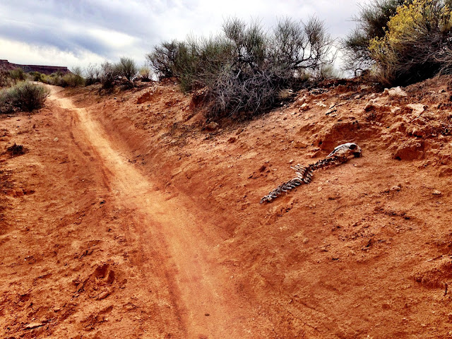
Dead Ringer

Image
If you're a fan of the Red Bull Rampage you've seen the crazy trail descents near Virgin, Utah. There's a great trail system along the same range west of that venue that offers world-class mountain biking. It began as the JEM (John, Ellen & Mike - creators) and has evolved into a network of climbs, multiple terrain, switchbacks, cliff hugging traverses, and high-speed cruises, all in the shadows of Zion Canyon. The network includes Dead Ringer - 5.2 mile, the JEM - 6.9 miles or 15.8 mile loop with Goulds, the Cryptobionic - 3.3 miles, and Goosebump - 3.6 miles, and More Cowbell - 2.7 miles. The network creates a number of loops making for several days worth of combos.  This post deals mainly with Dead Ringer.  There are a number of access points, this one is a junction of the JEM and Dead Ringer trails. The Dead Ringer continues to the right beyond the sign in the above image, skirts and climbs the two prominent flat mesas in the background, popping up ...

The Honeymoon Trail Traverse of the Colorado Plateau

Image
Track Stats Distance: 55 mile out-and-back Trail Rating: Moderate - Requiring high-clearance four-wheel drive Climb: Approximately 1300 feet Highlights: The Honeymoon Trail, fossils, incredible vistas Map:  Honeymoon Trail Traverse of the Colorado Plateau The Traverse The Honeymoon Trail is a popular track through Warner Valley, up the Colorado Plateau and southeast to Pipe Springs where it continued on to Lee's Ferry and beyond. It was the route used by turn-of-the-century Mormons making the trek to the temple in St. George for, among other things, to get married. Hence the name. Chastity never came at such a high price, considering the terrain and obstacles presented along this trail, not the least of which is its traverse of the edge of the Colorado Plateau. I've wanted to scout the upper part of this trail before I engaged the climb below. And I'm glad I did. There are a couple of ways to access the graded road that leads to the Honeymoon Trail...

The Warner Valley Traverse

Image
Track Stats Distance: 43.6 mile loop Trail Rating: Moderate - Requiring high-clearance four-wheel drive Climb: Approximately 700 feet Highlights: Dinosaur tracks, petroglyphs, mind-bending geology, incredible vistas Map: Warner Valley Traverse The Traverse Warner Valley sits on the southwestern border of Washington County and the Arizona Strip, a kind of no-man's land under the stewardship of the BLM. It's a destination for all off-road enthusiasts alike, not to mention those who like to discharge firearms, and as a result of all this activity, its environs are littered with everything from brass to toilet paper, beer cans being the most popular refuse. Sad, because this area holds vistas and geology unlike anything on or near the Colorado Plateau, our biggest secret in southern Utah, even though it might appear no one gives a crap about it.  I drive through Warner Valley a couple of times a week, shaking up my commute between St. George and Hurricane, ...