Neckskin Flappin' to Huntington Canyon
Friday, July 17

Tough to name this trip as I'm trying to get away from geographical titles like “Huntington Canyon.” Places might not mean as much to the discriminating reader as say, “Neckskin flappin” or “Chip Seal & Tar Snakes” or “The GSH” for Grand Staircase Highway.
All of which will play out in the prose to follow as I log our fourth road trip of the Summer, the same being the second trip with one of our five children. It's been our goal to take each on their own moto-camping trip. Here it is late July and we have three kids to go. Each child has their choice of destinations, within reason, and Addie our youngest at ten years decided to go to Huntington Canyon, the Summer retreat of her grandfather.
We got away midmorning Friday, we being Mindy, Addie and I, taking Highway 9 through Zion Canyon to 89 North. Addie had one “break-in” ride before this under 100 miles, and was still a bit unsure about this trip for a number of reasons; around 800 miles in three days, camping in the wild, being away from home, and having her mom out of town, enough to weigh down the heart and mind of an ever-analyzing woman/girl, old before her years. I don't get as much time as I'd like with her and was a bit anxious myself worrying that despite all the careful planning and packing, something might come along to ruin the trip, or worse, turn it catastrophic.
By the east entrance to Zion Addie had released her grip from my waist and stretched her arms wide turning the airfoils of her hands while she worked the subtleties of the Bernoulli effect. Her cares evaporated in the heat and I breathed a little easier.

We're at home together on craft, though it's almost always been a kayak instead of a motorcycle. On 89 at Orderville we stopped at a rock shop and found another craft, a Flintstonemobile. Passed it dozens of times, but this day it became a photo-op, and so did the modern stone-age weather forecasting device nearby.


Eighty-nine took us to the junction of Highway 12, the road to Bryce Canyon and all things Grand Staircase. In all the time I've lived in Southern Utah I've only ventured as far as Escalante on 12 while on assignment in the middle of the night. We've done Bryce a number of times, but beyond that turnoff, all was new for us.

We stopped outside of Henrieville to take in one of dozens of vistas we'd pass along the way, this one of Powell Point. At 10,188 feet, this landmark was used as a survey point for John Wesley Powell and his expedition.

This was also a good time to stretch.

We rolled into Escalante by midday and stopped at the Escalante Frosty Shop for lunch.


While Addie and I waited for our order, Mindy visited the Grand Staircase visitors' center across the street. The attendant she visited with indicated that many people have no idea what the Grand Staircase is, most thinking it's an actual staircase. One caller queried whether or not is was handicap accessible.

That got our wheels turning. Like the great attraction that is Four Corners, we could build a staircase here in Escalante, something like you saw in the grand house Tara in Gone With the Wind, and charge people to walk up it, and at the top they could shake hands with a Bill Clinton look-alike who made the Grand Staircase possible. If we build it they will come, I'm tellin' ya.

One hundred in the shade. Phew. But this was offset by Arnold Palmers. I asked the Frosty Shop owner if I could prepay for refills and he said, “Are you on bikes?” I nodded. “I'm not charging you for refills.” He's a biker, too, along with his spouse and his son who rides pro dirt bikes and has a tidy valve business out of Salt Lake.

The burgers were great, homemade buns and authentic Utah fry sauce.

There was another couple there with us, she on a Victory and he on a Yamaha Stratoliner, I think. A third member of their party was at the local bike shop waiting for a new belt to come in, her existing one got shredded by rock chips. The Yamaha had one embedded in its belt as well. This was their second day in beautiful Escalante, waiting for the part. And such is the beauty of chip seal, part of the UDOTMEP, but I'll get to that in a bit.
It was hot enough to lose our riding jackets and don suntan lotion instead of armor. At speed, say 70, and at my age, say 47, along with a headwind, the skin from my neck would gather where my bolts would be if I were Frankenstein, and flap in the breeze. Hence my new euphemism for motorcycle riding, neckskin flappin'.


Outside of Escalante Highway 12 steps up to a number of vistas, one of which was of this switchback covered with tar snakes, those sphincter-puckering crack filling gooey lines that throw your steering into an unanticipated direction, just for a split second. Again, another indicator of the UDOTMEP.

If you're still upright, 12 rises along side a canyon carved by Calf Creek reaching the Hog Back, where the road's shoulders drop away into valleys flanking the saddle-back.

Our view to the north showed smoke from a fire near Boulder Mountain, right where 12 would take us.

Sure enough, at Point Lookout, 9600 feet, smoke from the fire added some orange to the palate of the sky while ashes drizzled along as we cooled in the altitude. The aspens were thick and meadows green and the vista spectacular. This is where I realized 12 should be known as the Grand Staircase Highway, or the GSH. California has the PCH, why not Utah the GSH?

The ride from there winds down to 6,800 feet where we landed in Torrey at a new cheap motel that seemed to be disintegrating before our very eyes. We dined at the Rim Rock Inn east of town and had a top-rate meal – from the homemade tomato soup to the vanilla bean cheesecake, it was the best dinner I've had on the road in a long time. And of course, I left the camera back in the room.
Saturday, July 18
Saturday morning and a free breakfast buffet, despite the chubby shirtless boy... here's a road rule: don't show up at the hotel's free breakfast buffet without your shirt on. And if you do, don't stand over the waffle maker rubbing your belly over the little cups of waffle batter. Good hell.
Highway 12 turns to 24 at Torrey, the official end of the GSH. West to Biknell, Lyman and Loa, sanitized little rural Mormon towns so clean you can smell the Pine Sol. Highway 72 out of Loa winds through the even smaller town of Fremont up past Forsyth Lake to yet another vista, this one looking south the way we came.

For eighteen miles, 72 is undergoing the UDOTMEP, just like the stretch outside of Escalante that disabled one bike and handicapped another. It the Utah Department of Transportation Motorcycle Elimination Program. Locals know it as chip seal, the obviously lowest budget way to resurface roads in Utah.

Cover the surface in tar, then cover the tar with large gravel. Don't roll it in, the traffic will do that for you. Leave enough gravel to be kicked up into windshields, drive belts and teeth and leave plenty in the corners to induce white knuckled sphincter puckering.

Our descent into Escalante River Canyon had us plowing gravel, four inches deep. This freshly “sealed” section of 72 shows the UDOTMEP at its best. Once enough traffic has ground in the gravel and thrown the rest to the shoulders and median, UDOT comes along and stripes it.
At Hogan Pass there's a turnout for another vista, this one a smokey view of Canyonlands. This is my favorite shot of the trip.

It represents so much about my daughter, wanting to be ready for anything that might happen, trying to reduce as much uncertainty as she can, and despite her fears and worries, takes it all on and later smiles at her victories.
I like this one, too. My partner, who is just as at home on her ride as she is in her classroom.

Seventy-two was vacant almost our entire way to the junction with HWY 10.

Once we got past the chip seal the road begs more throttle and lean into all her corners. The tar snakes still keep you on your toes, though. This is the vista looking back over Paradise Valley.

North of there we rode past Last Chance Creek, and then North Last Chance, which I think makes the former the Second-to-Last Chance Creek. Wouldn't it? At the junction we passed a half-dozen riders going south.
Highway 10 north through the ghost towns of Emery, Ferron, Castle Dale, and then Huntington. They're not really ghost towns, I've just never seen anyone around whenever I travel through.
And I've done that many times since Huntington Canyon is somewhat hallowed ground for me. Take SR 31 west out of Huntington and you'll go up the canyon into Pine trees and the cool of the Huntington Creek that lines and air conditions the road. Ideal fly fishing.

Just before the Nuck Woodward Canyon Road is the Stuart Ranger Station, a USDF Historic Site that commemorates the Civilian Conservation Corps.

This is the garage, now converted to an interpretive display about the CCC. When my dad was a boy he and his family spent their Summers here. The garage was where he and my uncle slept.

My Grandfather, Lee E. Young, was the ranger there in the 20's and 30's and was instrumental in the CCC. My father and uncle would talk for hours about growing up here and my grandfather made the best of a program designed to put young men to work during the Great Depression, a true shovel-ready job working on forestry conservation.

The whole family spent Summers there from 1928 to 1939, spanning my father's fifth through his sixteenth year. The station has been restored to its original condition.

This is a shot of my grandfather on his horse that hangs inside the front room.

My father passed away in June, 2000. About a year later I took part of his cremains up the creek that runs behind the station and let them go into the water. It's what he wanted.
The station host warned us of three bear sightings and a cougar sighting the day before. Just what we wanted to hear as we mounted to find a place to camp.
We found Chute Campground, a group site that was reserved, but the group must have bugged out early. Maybe they were the ones that saw the bears. It's a beautiful site right on the creek.


Water from the river was purified with our handydandy MSR purifier. Took me about fifteen minutes to pump about three gallons into our collapsable 5-gallon jug.


The host also suggested Listerine as a way to keep the flies and mosquitoes away. After their relentless attack while we set up camp, we rode 31 over the mountain into Fairview and Mount Pleasant to pick some up, along with real bug spray and other goodies.

Back at camp, bike gear off and we're swarmed again. Mindy popped open the Listerine while I sprayed the Cutter... and sure enough, nothing went near her, while flies were still lighting on me. So I dowsed myself and wasn't bothered again.

If you moto-camp, you like things that can multi-task. Like my Sea-to-Summit dry bags; stuff a sleeping bag in it, or line the Beetle bag of the Blackbird, fill with ice and favorite beverages and it's a cooler. And so it goes for Listerine; mouthwash, antiseptic, bug repellant, scalp tonic (felt really nice and cool), mosquito bite salve, skin astringent, dish washing soap... it's WD-40 for the body.


We spent the afternoon playing the the creek, napping and talking. Clouds rolled in and thunder clapped and just as I was serving dinner the rain came down. The girls ate in the tent while I tried to contain everything outside.

We did around the campfire what you're all supposed to do around a campfire until the light was fleeting. And we turned in.

During the night we were startled by the sound of a tree snapping from its trunk and slamming into the ground. The sound came from across the river. We lay there holding our breath, waiting for the sound of the bear sloshing across the stream coming into our camp. That's when Addie joined us in our tent.
The breath-holding was for naught, though we were kept awake by something rooting around outside our tent. Morning light would show us that we were invaded by squirrels. Very large and menacing, I'm sure.
I felt pretty vulnerable, though. Usually we have the MotherShip when we go camping, our trusty Expedition, something we could all pile into if we had to. Not much protection on a motorcycle, in more was than the obvious.
We were finally able to settle down and sleep, well into the morning on Sunday.
Sunday, July 19

This was an ambitious day in planning, but after our harrowed night, Addie was ready for civilization. We packed and mounted, riding down the mountain again to Fairview where we picked up 89.

On the way we stopped at yet another vista, one that showed the wake of a pest that's destroyed over 80% of the trees in the Dixie and Manti/La Sal National forests. After years of this devastation, someone has found a cure to rid the beetles.

We rode 89 to I-70 to Richfield where we stopped at The Little Wonder Cafe, good food, decent prices, and if you're lucky, you can sit where Stephen King sat. We did.

We slabbed it home on I-70 to mind-numbing I-15 and had a very uneventful return home, safe, sans catastrophe, with new memories and closer ties than before. That's why we do this, right?

Tough to name this trip as I'm trying to get away from geographical titles like “Huntington Canyon.” Places might not mean as much to the discriminating reader as say, “Neckskin flappin” or “Chip Seal & Tar Snakes” or “The GSH” for Grand Staircase Highway.
All of which will play out in the prose to follow as I log our fourth road trip of the Summer, the same being the second trip with one of our five children. It's been our goal to take each on their own moto-camping trip. Here it is late July and we have three kids to go. Each child has their choice of destinations, within reason, and Addie our youngest at ten years decided to go to Huntington Canyon, the Summer retreat of her grandfather.
We got away midmorning Friday, we being Mindy, Addie and I, taking Highway 9 through Zion Canyon to 89 North. Addie had one “break-in” ride before this under 100 miles, and was still a bit unsure about this trip for a number of reasons; around 800 miles in three days, camping in the wild, being away from home, and having her mom out of town, enough to weigh down the heart and mind of an ever-analyzing woman/girl, old before her years. I don't get as much time as I'd like with her and was a bit anxious myself worrying that despite all the careful planning and packing, something might come along to ruin the trip, or worse, turn it catastrophic.
By the east entrance to Zion Addie had released her grip from my waist and stretched her arms wide turning the airfoils of her hands while she worked the subtleties of the Bernoulli effect. Her cares evaporated in the heat and I breathed a little easier.

We're at home together on craft, though it's almost always been a kayak instead of a motorcycle. On 89 at Orderville we stopped at a rock shop and found another craft, a Flintstonemobile. Passed it dozens of times, but this day it became a photo-op, and so did the modern stone-age weather forecasting device nearby.


Eighty-nine took us to the junction of Highway 12, the road to Bryce Canyon and all things Grand Staircase. In all the time I've lived in Southern Utah I've only ventured as far as Escalante on 12 while on assignment in the middle of the night. We've done Bryce a number of times, but beyond that turnoff, all was new for us.

We stopped outside of Henrieville to take in one of dozens of vistas we'd pass along the way, this one of Powell Point. At 10,188 feet, this landmark was used as a survey point for John Wesley Powell and his expedition.

This was also a good time to stretch.

We rolled into Escalante by midday and stopped at the Escalante Frosty Shop for lunch.


While Addie and I waited for our order, Mindy visited the Grand Staircase visitors' center across the street. The attendant she visited with indicated that many people have no idea what the Grand Staircase is, most thinking it's an actual staircase. One caller queried whether or not is was handicap accessible.

That got our wheels turning. Like the great attraction that is Four Corners, we could build a staircase here in Escalante, something like you saw in the grand house Tara in Gone With the Wind, and charge people to walk up it, and at the top they could shake hands with a Bill Clinton look-alike who made the Grand Staircase possible. If we build it they will come, I'm tellin' ya.

One hundred in the shade. Phew. But this was offset by Arnold Palmers. I asked the Frosty Shop owner if I could prepay for refills and he said, “Are you on bikes?” I nodded. “I'm not charging you for refills.” He's a biker, too, along with his spouse and his son who rides pro dirt bikes and has a tidy valve business out of Salt Lake.

The burgers were great, homemade buns and authentic Utah fry sauce.

There was another couple there with us, she on a Victory and he on a Yamaha Stratoliner, I think. A third member of their party was at the local bike shop waiting for a new belt to come in, her existing one got shredded by rock chips. The Yamaha had one embedded in its belt as well. This was their second day in beautiful Escalante, waiting for the part. And such is the beauty of chip seal, part of the UDOTMEP, but I'll get to that in a bit.
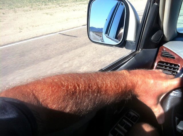
It was hot enough to lose our riding jackets and don suntan lotion instead of armor. At speed, say 70, and at my age, say 47, along with a headwind, the skin from my neck would gather where my bolts would be if I were Frankenstein, and flap in the breeze. Hence my new euphemism for motorcycle riding, neckskin flappin'.


Outside of Escalante Highway 12 steps up to a number of vistas, one of which was of this switchback covered with tar snakes, those sphincter-puckering crack filling gooey lines that throw your steering into an unanticipated direction, just for a split second. Again, another indicator of the UDOTMEP.

If you're still upright, 12 rises along side a canyon carved by Calf Creek reaching the Hog Back, where the road's shoulders drop away into valleys flanking the saddle-back.

Our view to the north showed smoke from a fire near Boulder Mountain, right where 12 would take us.

Sure enough, at Point Lookout, 9600 feet, smoke from the fire added some orange to the palate of the sky while ashes drizzled along as we cooled in the altitude. The aspens were thick and meadows green and the vista spectacular. This is where I realized 12 should be known as the Grand Staircase Highway, or the GSH. California has the PCH, why not Utah the GSH?

The ride from there winds down to 6,800 feet where we landed in Torrey at a new cheap motel that seemed to be disintegrating before our very eyes. We dined at the Rim Rock Inn east of town and had a top-rate meal – from the homemade tomato soup to the vanilla bean cheesecake, it was the best dinner I've had on the road in a long time. And of course, I left the camera back in the room.
Saturday, July 18
Saturday morning and a free breakfast buffet, despite the chubby shirtless boy... here's a road rule: don't show up at the hotel's free breakfast buffet without your shirt on. And if you do, don't stand over the waffle maker rubbing your belly over the little cups of waffle batter. Good hell.
Highway 12 turns to 24 at Torrey, the official end of the GSH. West to Biknell, Lyman and Loa, sanitized little rural Mormon towns so clean you can smell the Pine Sol. Highway 72 out of Loa winds through the even smaller town of Fremont up past Forsyth Lake to yet another vista, this one looking south the way we came.

For eighteen miles, 72 is undergoing the UDOTMEP, just like the stretch outside of Escalante that disabled one bike and handicapped another. It the Utah Department of Transportation Motorcycle Elimination Program. Locals know it as chip seal, the obviously lowest budget way to resurface roads in Utah.

Cover the surface in tar, then cover the tar with large gravel. Don't roll it in, the traffic will do that for you. Leave enough gravel to be kicked up into windshields, drive belts and teeth and leave plenty in the corners to induce white knuckled sphincter puckering.

Our descent into Escalante River Canyon had us plowing gravel, four inches deep. This freshly “sealed” section of 72 shows the UDOTMEP at its best. Once enough traffic has ground in the gravel and thrown the rest to the shoulders and median, UDOT comes along and stripes it.
At Hogan Pass there's a turnout for another vista, this one a smokey view of Canyonlands. This is my favorite shot of the trip.

It represents so much about my daughter, wanting to be ready for anything that might happen, trying to reduce as much uncertainty as she can, and despite her fears and worries, takes it all on and later smiles at her victories.
I like this one, too. My partner, who is just as at home on her ride as she is in her classroom.

Seventy-two was vacant almost our entire way to the junction with HWY 10.

Once we got past the chip seal the road begs more throttle and lean into all her corners. The tar snakes still keep you on your toes, though. This is the vista looking back over Paradise Valley.

North of there we rode past Last Chance Creek, and then North Last Chance, which I think makes the former the Second-to-Last Chance Creek. Wouldn't it? At the junction we passed a half-dozen riders going south.
Highway 10 north through the ghost towns of Emery, Ferron, Castle Dale, and then Huntington. They're not really ghost towns, I've just never seen anyone around whenever I travel through.
And I've done that many times since Huntington Canyon is somewhat hallowed ground for me. Take SR 31 west out of Huntington and you'll go up the canyon into Pine trees and the cool of the Huntington Creek that lines and air conditions the road. Ideal fly fishing.

Just before the Nuck Woodward Canyon Road is the Stuart Ranger Station, a USDF Historic Site that commemorates the Civilian Conservation Corps.

This is the garage, now converted to an interpretive display about the CCC. When my dad was a boy he and his family spent their Summers here. The garage was where he and my uncle slept.

My Grandfather, Lee E. Young, was the ranger there in the 20's and 30's and was instrumental in the CCC. My father and uncle would talk for hours about growing up here and my grandfather made the best of a program designed to put young men to work during the Great Depression, a true shovel-ready job working on forestry conservation.

The whole family spent Summers there from 1928 to 1939, spanning my father's fifth through his sixteenth year. The station has been restored to its original condition.

This is a shot of my grandfather on his horse that hangs inside the front room.

My father passed away in June, 2000. About a year later I took part of his cremains up the creek that runs behind the station and let them go into the water. It's what he wanted.
The station host warned us of three bear sightings and a cougar sighting the day before. Just what we wanted to hear as we mounted to find a place to camp.
We found Chute Campground, a group site that was reserved, but the group must have bugged out early. Maybe they were the ones that saw the bears. It's a beautiful site right on the creek.


Water from the river was purified with our handydandy MSR purifier. Took me about fifteen minutes to pump about three gallons into our collapsable 5-gallon jug.


The host also suggested Listerine as a way to keep the flies and mosquitoes away. After their relentless attack while we set up camp, we rode 31 over the mountain into Fairview and Mount Pleasant to pick some up, along with real bug spray and other goodies.

Back at camp, bike gear off and we're swarmed again. Mindy popped open the Listerine while I sprayed the Cutter... and sure enough, nothing went near her, while flies were still lighting on me. So I dowsed myself and wasn't bothered again.

If you moto-camp, you like things that can multi-task. Like my Sea-to-Summit dry bags; stuff a sleeping bag in it, or line the Beetle bag of the Blackbird, fill with ice and favorite beverages and it's a cooler. And so it goes for Listerine; mouthwash, antiseptic, bug repellant, scalp tonic (felt really nice and cool), mosquito bite salve, skin astringent, dish washing soap... it's WD-40 for the body.


We spent the afternoon playing the the creek, napping and talking. Clouds rolled in and thunder clapped and just as I was serving dinner the rain came down. The girls ate in the tent while I tried to contain everything outside.

We did around the campfire what you're all supposed to do around a campfire until the light was fleeting. And we turned in.

During the night we were startled by the sound of a tree snapping from its trunk and slamming into the ground. The sound came from across the river. We lay there holding our breath, waiting for the sound of the bear sloshing across the stream coming into our camp. That's when Addie joined us in our tent.
The breath-holding was for naught, though we were kept awake by something rooting around outside our tent. Morning light would show us that we were invaded by squirrels. Very large and menacing, I'm sure.
I felt pretty vulnerable, though. Usually we have the MotherShip when we go camping, our trusty Expedition, something we could all pile into if we had to. Not much protection on a motorcycle, in more was than the obvious.
We were finally able to settle down and sleep, well into the morning on Sunday.
Sunday, July 19

This was an ambitious day in planning, but after our harrowed night, Addie was ready for civilization. We packed and mounted, riding down the mountain again to Fairview where we picked up 89.

On the way we stopped at yet another vista, one that showed the wake of a pest that's destroyed over 80% of the trees in the Dixie and Manti/La Sal National forests. After years of this devastation, someone has found a cure to rid the beetles.

We rode 89 to I-70 to Richfield where we stopped at The Little Wonder Cafe, good food, decent prices, and if you're lucky, you can sit where Stephen King sat. We did.

We slabbed it home on I-70 to mind-numbing I-15 and had a very uneventful return home, safe, sans catastrophe, with new memories and closer ties than before. That's why we do this, right?


Comments
Post a Comment